FRANCISCO is undergoing extratropical transition. At 8 am, FRANCISCO was centred about 410 km (220 NM) S of Tokyo.
范斯高正轉化為溫帶氣旋。在上午 8 時,范斯高集結在東京以南約 410 公里 (220 海里)。
TC
Naming 氣旋命名
FRANCISCO is the 41st name in the tropical cyclone name list. It was contributed by the USA, and is a Chamorro male name. This name was used in 2001 and 2007; the latter necessitated a #1 Standby Signal.
FRANCISCO is the 41st name in the tropical cyclone name list. It was contributed by the USA, and is a Chamorro male name. This name was used in 2001 and 2007; the latter necessitated a #1 Standby Signal.
FRANCISCO is expected to accelerate towards the NE/ENE along the westerlies.
范斯高將沿西風帶向東北或東北偏東加速移動。
Intensity
Analysis 強度分析
Current T-number: T3.0/3.5/W0.5/24 HRS
Shear is now too high for FRANCISCO to maintain its symmetric structure. The storm is expected to weaken and transform into an extratropical cyclone within the next 36 hours.
現時的 T 號碼: T3.0/3.5/W0.5/24 HRS
范斯高受較高垂直風切變影響,難以維持對稱結構。預料風暴會繼續減弱,並於 36 小時內轉化為溫帶氣旋。
Effects on
Hong Kong 對香港的影響
No threat to Hong Kong is expected within the next 72 hours.
預料范斯高於未來的 72 小時將不會對香港構成影響。
Next Update
下次更新
2013/10/26 (Sat 六), afternoon 下午 (or earlier 或更早)
Other Images
其他圖像
JTWC Track 聯合颱風警報中心路徑圖
JMA Track 日本氣象廳路徑圖
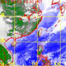
HKO Satellite 香港天文台衛星圖
HKO Track 香港天文台路徑圖
Probabilities
of TC Signals from HKO 香港天文台發出 / 取消熱帶氣旋警告信號的機率
FRANCISCO is the 41st name in the tropical cyclone name list. It was contributed by the USA, and is a Chamorro male name. This name was used in 2001 and 2007; the latter necessitated a #1 Standby Signal.
The subtropical ridge is retreating and FRANCISCO is expected to recurve and accelerate along the westerlies. The other cyclone LEKIMA is likely to be getting close between t+48 and t+72, but both of them will be under strong steering influence and significant interaction is not expected at this moment.
Current T-number: T3.5/4.0/W0.5/24 HRS
FRANCISCO is barely maintaining typhoon intensity. At low sea temperatures and heightening shear FRANCISCO will weaken and transform into an extratropical cyclone by t+72.
現時的 T 號碼: T3.5/4.0/W0.5/24 HRS
范斯高勉強維持颱風強度。受較冷海水及開始增加的垂直風切變之影響,預料范斯高會逐漸減弱,於 72 小時內轉化為溫帶氣旋。
Effects on
Hong Kong 對香港的影響
No threat to Hong Kong is expected within the next 72 hours.
預料范斯高於未來的 72 小時將不會對香港構成影響。
Next Update
下次更新
2013/10/25 (Fri 五), afternoon 下午 (or earlier 或更早)
Other Images
其他圖像
JTWC Track 聯合颱風警報中心路徑圖
JMA Track 日本氣象廳路徑圖
HKO Satellite 香港天文台衛星圖
HKO Track 香港天文台路徑圖
Probabilities
of TC Signals from HKO 香港天文台發出 / 取消熱帶氣旋警告信號的機率
FRANCISCO is the 41st name in the tropical cyclone name list. It was contributed by the USA, and is a Chamorro male name. This name was used in 2001 and 2007; the latter necessitated a #1 Standby Signal.
FRANCISCO is expected to move NW turning to NNW along the western periphery of the subtropical ridge, and recurve after t+24. It will accelerate along the westerlies at later taus. The other cyclone LEKIMA is likely to be getting close by t+72, but both of them will be under strong steering influence and significant interaction is not expected at this moment.
Current T-number: T4.0/4.5/W1.0/24 HRS
FRANCISCO is now subject to cool sea temperatures (below 26 degrees) and is expected to weaken gradually. After recurvature FRANCISCO will encounter strong vertical wind shear, and extratropical transition is expected between t+72 and t+96.
FRANCISCO is the 41st name in the tropical cyclone name list. It was contributed by the USA, and is a Chamorro male name. This name was used in 2001 and 2007; the latter necessitated a #1 Standby Signal.
FRANCISCO is expected to move NW turning to NNW along the western periphery of the subtropical ridge, and recurve near t+48.
范斯高將沿副熱帶高壓脊西部向西北轉西北偏北移動,於 t+48 前後轉向。
Intensity
Analysis 強度分析
Current T-number: T5.0/5.0/S0.0/24 HRS
FRANCISCO's intensity remained stable over the past 24 hours. The storm is expected to weaken in an area of decreasing sea temperatures, but good outflow should somewhat reduce the rate of weakening. After recurvature FRANCISCO will encounter strong vertical wind shear, and extratropical transition is expected by t+96.
現時的 T 號碼: T5.0/5.0/S0.0/24 HRS
范斯高的強度於過去 24 小時大致穩定,預料它會於水溫下降的環境下減弱,但良好輻散或可稍為減慢減弱的幅度。轉向後范斯高將受高垂直風切變影響,預料會於 t+96 轉化為溫帶氣旋。
Effects on
Hong Kong 對香港的影響
No threat to Hong Kong is expected within the next 72 hours.
預料范斯高於未來的 72 小時將不會對香港構成影響。
Next Update
下次更新
2013/10/23 (Wed 三), afternoon 下午 (or earlier 或更早)
Other Images
其他圖像
JTWC Track 聯合颱風警報中心路徑圖
JMA Track 日本氣象廳路徑圖
HKO Satellite 香港天文台衛星圖
HKO Track 香港天文台路徑圖
Probabilities
of TC Signals from HKO 香港天文台發出 / 取消熱帶氣旋警告信號的機率
FRANCISCO is the 41st name in the tropical cyclone name list. It was contributed by the USA, and is a Chamorro male name. This name was used in 2001 and 2007; the latter necessitated a #1 Standby Signal.
FRANCISCO is expected to move NNW along the southwestern periphery of the subtropical ridge, and turn to NW near t+24 in response to the ridge's shape. The storm is still expected to recurve near t+72.
Current T-number: T5.0/5.5/W2.0/24 HRS
FRANCISCO's eye becomes cloud-filled. The storm is expected to weaken in an area of decreasing sea temperatures, but good outflow should somewhat reduce the rate of weakening. After recurvature FRANCISCO will encounter strong vertical wind shear, and extratropical transition is expected by t+120.
現時的 T 號碼: T5.0/5.5/W2.0/24 HRS
范斯高的風眼被雲帶填入,預料它會於水溫下降的環境下減弱,但良好輻散或可稍為減慢減弱的幅度。轉向後范斯高將受高垂直風切變影響,預料會於 t+120 轉化為溫帶氣旋。
Effects on
Hong Kong 對香港的影響
No threat to Hong Kong is expected within the next 72 hours.
預料范斯高於未來的 72 小時將不會對香港構成影響。
Next Update
下次更新
2013/10/22 (Tue 二), afternoon 下午 (or earlier 或更早)
Other Images
其他圖像
JTWC Track 聯合颱風警報中心路徑圖
JMA Track 日本氣象廳路徑圖
HKO Satellite 香港天文台衛星圖
HKO Track 香港天文台路徑圖
Probabilities
of TC Signals from HKO 香港天文台發出 / 取消熱帶氣旋警告信號的機率
FRANCISCO has intensified into the second category 5 super typhoon this year in the NW Pacific basin. At 8 am, FRANCISCO was centred about 860 km (470 NM) SSW of Iwo Jima.
FRANCISCO is the 41st name in the tropical cyclone name list. It was contributed by the USA, and is a Chamorro male name. This name was used in 2001 and 2007; the latter necessitated a #1 Standby Signal.
FRANCISCO is expected to move NW along the southwestern periphery of the subtropical ridge, and recurve later along its western periphery.
范斯高將沿副熱帶高壓脊西南部向西北移動,隨後將圍繞副高轉向。
Intensity
Analysis 強度分析
Current T-number: T7.0/7.0/S0.0/24 HRS
FRANCISCO recovered its southwestern quadrant yesterday and further deepened. It is believed to have reached the environmental limit in that region, and as sea temperatures drop later the storm is expected to weaken.
現時的 T 號碼: T7.0/7.0/S0.0/24 HRS
范斯高昨天收復西南象限減弱的趨勢,更進一步增強。范斯高應到達該區大氣環境可容忍的強度上限,預料隨後當海溫開始下降時將會減弱。
Effects on
Hong Kong 對香港的影響
No threat to Hong Kong is expected within the next 72 hours.
預料范斯高於未來的 72 小時將不會對香港構成影響。
Next Update
下次更新
2013/10/21 (Mon 一), afternoon 下午 (or earlier 或更早)
Other Images
其他圖像
JTWC Track 聯合颱風警報中心路徑圖
JMA Track 日本氣象廳路徑圖
HKO Satellite 香港天文台衛星圖
HKO Track 香港天文台路徑圖
Probabilities
of TC Signals from HKO 香港天文台發出 / 取消熱帶氣旋警告信號的機率
FRANCISCO is the 41st name in the tropical cyclone name list. It was contributed by the USA, and is a Chamorro male name. This name was used in 2001 and 2007; the latter necessitated a #1 Standby Signal.
FRANCISCO is expected to move NW along the southwestern periphery of the subtropical ridge, and recurve later along its western periphery.
范斯高將沿副熱帶高壓脊西南部向西北移動,隨後將圍繞副高轉向。
Intensity
Analysis 強度分析
Current T-number: T7.0/7.0/D1.5/24 HRS
FRANCISCO's eyewall cloud top temperatures continued to decrease. However, during the past 3 hours the storm's SW quadrant has shown signs of weakening and an eyewall replacement cycle may be imminent. FRANCISCO is not expected to intensify during that time, and later on it will reach cooler seas which will further inhibit development.
現時的 T 號碼: T7.0/7.0/D1.5/24 HRS
范斯高的眼牆雲頂溫度繼續下降,但其西南象限於過去 3 小時出現減弱跡象,風暴短期內或進入眼牆置換週期,預料期間風暴不會增強。隨後范斯高將進入海溫較低的區域,其發展將進一步受限制。
Effects on
Hong Kong 對香港的影響
No threat to Hong Kong is expected within the next 72 hours.
預料范斯高於未來的 72 小時將不會對香港構成影響。
Next Update
下次更新
2013/10/20 (Sun 日), afternoon 下午 (or earlier 或更早)
Other Images
其他圖像
JTWC Track 聯合颱風警報中心路徑圖
JMA Track 日本氣象廳路徑圖
HKO Satellite 香港天文台衛星圖
HKO Track 香港天文台路徑圖
Probabilities
of TC Signals from HKO 香港天文台發出 / 取消熱帶氣旋警告信號的機率
FRANCISCO is the 41st name in the tropical cyclone name list. It was contributed by the USA, and is a Chamorro male name. This name was used in 2001 and 2007; the latter necessitated a #1 Standby Signal.
FRANCISCO is expected to move NW along the southwestern periphery of the subtropical ridge, and turn poleward later as it reaches the western periphery of the ridge.
范斯高將沿副熱帶高壓脊西南部向西北移動,隨後到達副高西部,移向將逐漸轉北。
Intensity
Analysis 強度分析
Current T-number: T5.5/5.5/D1.5/24 HRS
FRANCISCO's eye is becoming clearer and its central dense overcast is growing. The storm is expected to strengthen further in the next 36 hours, with a possibility of reaching category 5 strength. It is expected to weaken later on as sea temperatures drops, especially after the passage of the previous cyclone WIPHA.
現時的 T 號碼: T5.5/5.5/D1.5/24 HRS
范斯高的風眼逐漸變得清晰,其中心密集雲區正擴大。預料在良好環境下范斯高會於未來 36 小時增強,有機會達到五級超級颱風強度。由於北方海水溫度於韋帕經過後下降,預料范斯高會於預測後期減弱。
Effects on
Hong Kong 對香港的影響
No threat to Hong Kong is expected within the next 72 hours.
預料范斯高於未來的 72 小時將不會對香港構成影響。
Next Update
下次更新
2013/10/19 (Sat 六), afternoon 下午 (or earlier 或更早)
Other Images
其他圖像
JTWC Track 聯合颱風警報中心路徑圖
JMA Track 日本氣象廳路徑圖
HKO Satellite 香港天文台衛星圖
HKO Track 香港天文台路徑圖
Probabilities
of TC Signals from HKO 香港天文台發出 / 取消熱帶氣旋警告信號的機率
26W intensified quickly last night and this morning, attaining typhoon strength. It was named FRANCISCO by the JMA. At 8 am, FRANCISCO was centred about 350 km (190 NM) SW of Guam.
FRANCISCO is the 41st name in the tropical cyclone name list. It was contributed by the USA, and is a Chamorro male name. This name was used in 2001 and 2007; the latter necessitated a #1 Standby Signal.
Ridge influence is increasing to the east of FRANCISCO. The storm is expected to move N along the western periphery of the subtropical ridge, and later turning NW as it reaches the ridge's western extension. It will resume its poleward movement later on, moving along the periphery of the ridge.
Current T-number: T4.0/4.0/D2.5/24 HRS
FRANCISCO intensified significantly over the past 24 hours in an area of warm seas with excellent outflow, developing an eye in less than a day. The storm is expected to strengthen further in the next 72 hours, becoming a strong typhoon by that time. It is expected to weaken later on as sea temperatures drops, especially after the passage of the previous cyclone WIPHA.
現時的 T 號碼: T4.0/4.0/D2.5/24 HRS
范斯高在溫暖海域及極佳輻散環境下於過去 24 小時明顯增強,不消一日便發展出風眼。預料在良好環境下范斯高會於未來 72 小時增強,屆時成為一較強颱風。由於北方海水溫度於韋帕經過後下降,預料范斯高會於預測後期減弱。
Effects on
Hong Kong 對香港的影響
No threat to Hong Kong is expected within the next 72 hours.
預料范斯高於未來的 72 小時將不會對香港構成影響。
Next Update
下次更新
2013/10/18 (Fri 五), afternoon 下午 (or earlier 或更早)
Other Images
其他圖像
JTWC Track 聯合颱風警報中心路徑圖
JMA Track 日本氣象廳路徑圖
HKO Satellite 香港天文台衛星圖
HKO Track 香港天文台路徑圖
Probabilities
of TC Signals from HKO 香港天文台發出 / 取消熱帶氣旋警告信號的機率
26W is expected to move WSW briefly due to the ridge NW of the system. The ridge will weaken a bit and re-orientate near t+24, and 26W should turn north along the western periphery of the eastern ridge. As it goes north and reaches the ridge's western extension, 26W will move more equatorward.
 Active Tropical Cyclone(s) 正活躍之熱帶氣旋